The Coral Triangle
The Coral Triangle is officially defined as the region encompassing Indonesia, Malaysia, the Philippines, Papua New-Guinea, Timor-Lest, and the Solomon Islands. This region covers nearly 6 million km2, which is roughly three-quarters the land area of Australia.
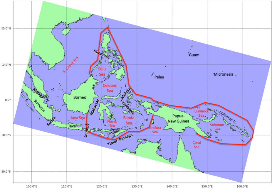
Official boundaries of the Coral Triangle are outlined in red, and major features are labeled
The Coral Triangle is widely considered the apex of marine biodiversity for several major taxonomic groups (Tittensor et al. 2010), and particularly for zooxanthellate corals (Veron et al. 2009). The figure below reflects the major ecoregions that have been identified for the Coral Triangle. These ecoregions define "geographically distinct assemblages of species, natural communities, and environmental conditions" (Green and Mous, 2008)
There are eleven defined ecoregions:
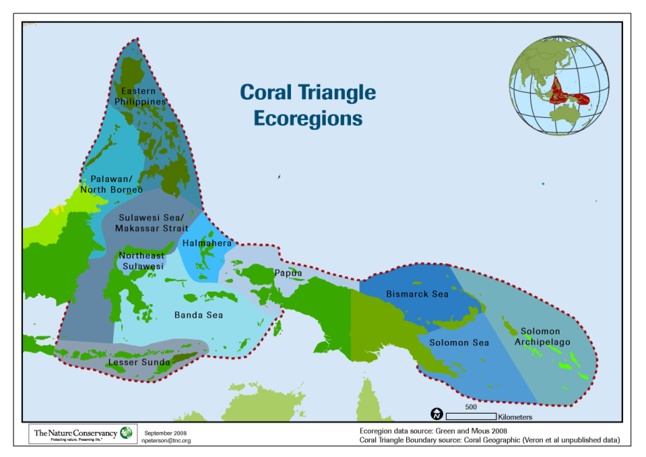
- Eastern Phillipines
- Palawan and North Borneo
- Sulawesi Sea and Makassar Strait
- Noreast Sulawesi
- Halmahere
- Banda Sea
- Lesser Sunda
- Papua
- Bismarck Sea
- Solomon Sea
- Solomon Archipelago
The distribution of reefs, as seen in the map below, within each ecoregion highlights why this region is called the "Coral Triangle."
The Coral Triangle Initiative
Conservation in the Coral Triangle has become a top priority of state governments and international conservation efforts, and the six Coral Triangle countries established the Coral Triangle Initiative (CTI) in 2007. The CTI commits to ensure long-term sustainability of the region by addressing multiple threats such as pollution and overfishing, as well as climate change.
Physical Oceanograph
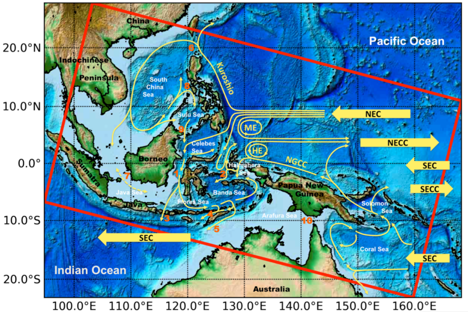
The oceanographic complexity of this region presents challenges to both field oceanographers and numerical modelers (Gordon and Kamenkovich, 2010). The Indonesian Throughflow (ITF), in particular, is widely recognized as a major pathway for water exchange between the Indian and Pacific Oceans, and a factor in climate phenomena such as El Niño-Southern Oscillation (ENSO), the Indian Ocean Dipole (IOD), or the Asian Monsoon. But few comprehensive studies have been conducted here. Fortunately, recent field campaigns such as INSTANT (International Nusantara STratification ANd Transport; Gordon et al., 2010) measured key variables (e.g., water transport in Makassar Strait and other major passages) that provide:
- Insights into physical mechanisms that drive circulation patterns
- Data for evaluating numerical model simulations within the region